SUPARCO Releases Satellite Images of Flood-Hit Areas in Punjab
Islamabad:Pakistan’s national space agency, **SUPARCO**, has released satellite images showing the devastation caused by the recent floods in Punjab.
Heavy monsoon rains, coupled with the release of water from India, have triggered large-scale flooding in several districts of Punjab after wreaking havoc in Khyber Pakhtunkhwa. Multiple **embankments collapsed**, allowing floodwaters to sweep into populated areas, submerging crops and forcing thousands of residents to flee to safer locations.


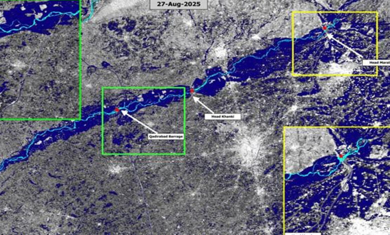
The **satellite images** capture the situation before and after the floods:
* The **image from August 22** shows rivers flowing within their natural boundaries.
* The **image from August 24** reveals rivers overflowing, with floodwaters spreading far beyond their banks, inundating vast stretches of land.
Officials said the imagery will play a crucial role in **assessing the scale of damage** and guiding **relief and rescue operations** in the affected regions.
Would you like me to make this news piece **short and crisp for social media posting** as well?